MEMBER SPOTLIGHT
November 22, 2021
This week we recognize the work of artist Linda Gass.
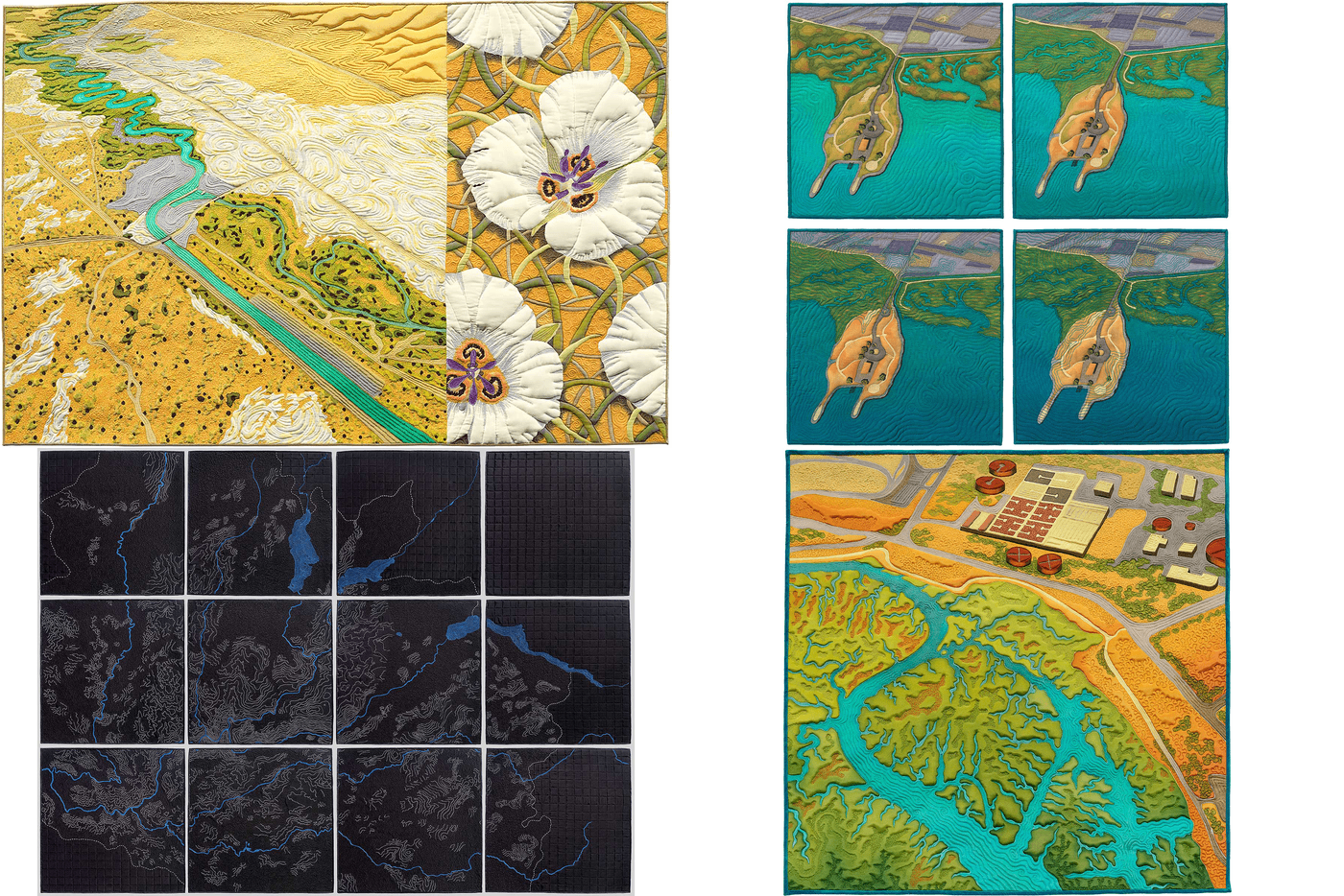
San Francisco Bay Area multimedia artist Linda Gass creates stitched paintings and works in glass to question the relationship between humans and their environment. Informed and inspired by her extensive research on the impact of changing waterways, sea-level rise, fire and drought in California and the American West, her work uses beauty to shed light on difficult issues. "I am inspired by the relationship between humans and the water and land that sustain them. My work explores how landscapes change over time focusing on those places where destruction and renewal, wounding and healing, absence and presence overlap."
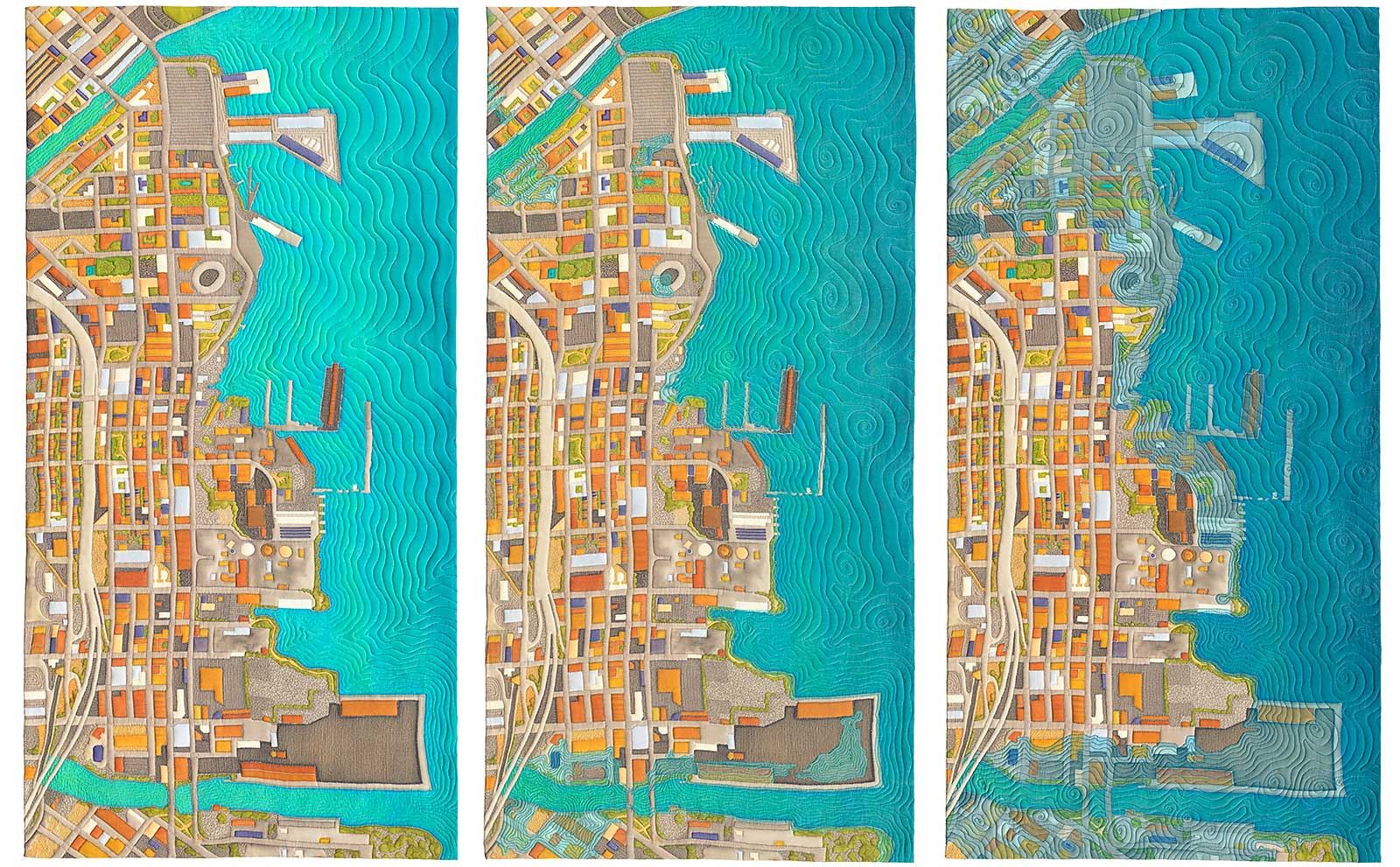
Dogpatch, the sea is rising: 0, 3 and 6 feet, 2019
Sea level rise, caused by the thermal expansion of warming ocean water and the melting of land ice, is a significant climate change threat to coastal. From 1900 to 2016 global sea level has risen by 7-8 inches and the rate has increased to a rate of about 1/8” per year. The most recent scientific estimates for San Francisco Bay were released in 2018 by the California Ocean Protection Council (a State Government appointed council). Projections for 2050 are relatively modest with a likely increase of 1-foot. However, by 2100 the likely projection puts sea-level rise at between 3 to 6 feet. The range of projections is affected by whether carbon emission levels fall significantly or if they continue at current levels.
"Using sea-level rise maps published by the U.S. National Oceanic and Atmospheric Association (NOAA), I have created a triptych of artworks showing the present day and the impact of 3 and 6 feet of sea level rise on the Dogpatch neighborhood of San Francisco. If you are familiar with this are, you may recognize familiar features such as the new Chase Center in Mission Bay and Oracle Park to the north."
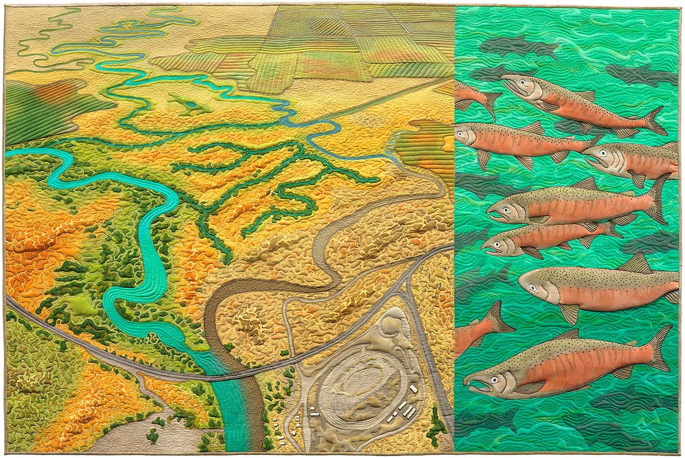
San Joaquin Merced Revival, 2012
San Joaquin Merced Revival is part of a series about confluences of bodies of water that no longer exist due to human impact. The artwork shows a birds-eye view of where the confluence of the San Joaquin and Merced rivers once was, paired with endangered Chinook salmon. Before the San Joaquin was dammed and heavily diverted for agriculture in the 1940s, the river was the largest in Central California and supported spring and fall salmon runs of over 300,000 fish. The completion of the Friant Dam in 1942 and the diversion of water into the Friant-Kern Canal left little more than a trickle below the dam in most years, drying up the San Joaquin before it reaches its confluence with the Merced. As a result, the count of Chinook salmon fell to zero by the 1950s and the spring and fall salmon runs became extinct.
Although this situation may seem hopeless, there is an effort underway to restore the river and the Chinook salmon runs. In 1988, 13 plaintiffs filed a lawsuit and successfully proved that the Friant Dam's diversion of water from the San Joaquin River violated the Endangered Species Act and California's public trust policies. Eventually a settlement was reached in 2006, requiring the river flow and the salmon runs to be restored. Restoration efforts are currently underway.
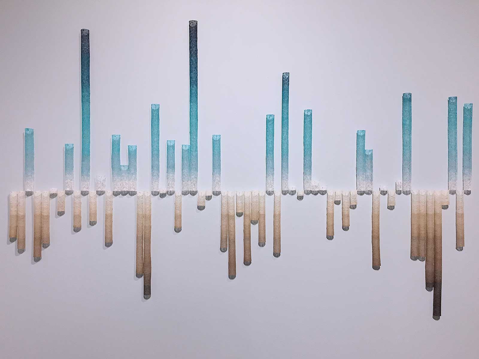
Some day there may be no more snow: California snowpack 1960 – 2019
This data visualization artwork shows the average annual snow water equivalent for the state of California for the years 1960 – 2019. The snow water equivalent is a critical measurement: the state’s water delivery system of dams and reservoirs was designed to rely on the snowpack’s natural reservoir. The mountains store vast quantities of winter precipitation as frozen snow until late spring when it begins melting, slowly releasing water throughout the summer to replenish the human-made reservoirs.
The artwork shows that California has very few “normal” years; for as long as humans have kept track, it never has. Flood and drought are the normal, however the data shows the water content is on a downward trend. The decrease is caused by warmer winter air temperatures where less precipitation falls in the form of snow. The delicate thread-lace columns evoke the shape of the tubes used by snow surveyors to measure the snow pack and their shaded gradation help the viewer see the extremes in the data.
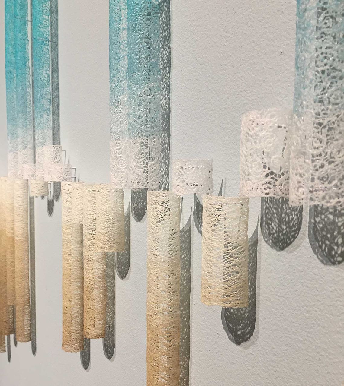
Some day there may be no more snow: California Snowpack 1960-2019, 2019 (detail)
Linda Gass is best known for her intricately stitched paintings about climate change, land use, and water issues in California and the American West. She graduated from Stanford University with a BS in Mathematics and MS in Computer Science and has been creating art for more than 20 years after a decade-long career in software. Her work has been exhibited throughout the US, in Europe and Russia, and at venues including the Museum of Craft and Design, Oakland Museum, the Bellevue Arts Museum, and the US Embassy in Moscow; and has been written about in National Geographic’s All Over the Map: A Cartographic Odyssey, and American Craft as well as other publications. Gass's work is held in several public and private collections including the International Quilt Museum, San Jose Museum of Quilts and Textiles, and Zuckerberg San Francisco General Hospital. lindagass.com
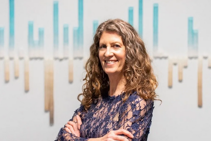
Featured Images: ©Linda Gass, Dogpatch, the sea is rising: 0, 3, and 6 feet, 2019, silk painting, digital scanning , digital image manipulation (Adobe Photoshop), digital printing on silk, machine quilting, 35.5 x 60 x 1.5 inches (Top); San Joaquin Merced Revival, 2012, silk painting and machine quilting, 30 x 45 x .5 inches; Some day there may be no more snow: California Snowpack 1960-2019, 2019, cotton, rayon and clear polyester, monofilament thread, dissolvable stabilizer, fabric stiffener, magnets, nails, 58 x 90 x 1.25 inches (bottom). Portrait of the artist at the Museum of Craft and Design, San Francisco, 2020 (Below).
